Photo: Taryn Eyton/HappiestOutdoors.ca
This one-way transit-accessible hike along a section of North Vancouver’s Baden Powell Trail is perfect for spring since it includes rushing waterfalls and mossy forests. The route goes from Deep Cove, across the churning waters of the Seymour River, to its finish at the Lynn Canyon Suspension Bridge.
Trail Info: Moderate; 11 km one-way; 3.5-4.5 hours; 370 m elevation gain; dogs allowed on leash
Safety First: AdventureSmart recommends bringing a backpack with essential safety and first aid gear on every hike. Check the forecast and pack extra clothing for the weather. Leave a trip plan so someone knows where you are going and when you will be back.
Getting There By Public Transit: Since this is a one-way hike, it is easiest to get there by bus. To get to the start, take one of many buses to Phibbs Exchange in North Vancouver. Use Translink’s trip planner tool for detailed routing. From there, take bus 215 to the stop on Indian River Drive near Mount Seymour Road. When you finish the trail in Lynn Valley, catch bus 227 from the stop on Peters Road to head back to Phibbs Exchange.
Getting There by Car: You can also get to this one-way hike by car. Leave a car at each end, or take the bus in between trailheads.
To get to the start from Vancouver, take Highway 1 north over the Iron Workers Memorial (Second Narrows) Bridge. Take exit 22B for Mount Seymour Parkway and follow it for 4.4 km. At the traffic light near Parkgate Village Shopping Centre, turn left onto Mount Seymour Park Road. Turn left a few blocks later onto Anne Macdonald Way, then turn right immediately into a parking lot signed “Old Buck Trailhead”.
To get to the finish from Vancouver, take Highway 1 north over the Iron Workers Memorial (Second Narrows) Bridge. Take exit 21 for Mountain Highway. Stay on Mountain Highway for 2.5 km, then turn right onto Lynn Valley Road. A few blocks later, turn right onto Peters Road. The pay parking lot for Lynn Canyon is at the end of the road. It can be very busy on weekends.
The Trail: This hike follows a section of the Baden Powell across the lower flanks of North Vancouver’s mountains. Your route involves countless intersections with other trails, but it is well-marked throughout with fleur-de-lis symbols, a reference to the Boy Scouts who built the trail in 1971. Use an app like All Trails or Gaia GPS to help you stay on track. Many of these trails are shared with mountain bikers, so be sure to listen for their approach.
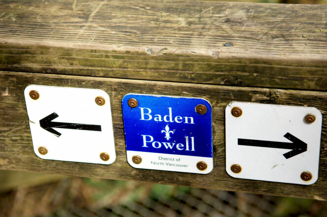
Baden Powell Trail Marker. Photo: JohnHarvey/Wikipedia. Used under CC BY-SA 3.0
This hike starts on the Old Buck Trail Trailhead. If you took the bus, walk north along Mount Seymour Road for 200 m, then turn left onto Anne McDonald Way. The Old Buck Trailhead will be on your right at the back of a signed parking lot. Your route starts with a hefty climb as you follow the wide Old Buck Trail up through the forest. Ignore intersections with other trails until you reach a major intersection about 2.2 km from the trailhead. Turn left to join the Baden Powell Trail.
The Baden Powell Trail continues to climb for another kilometre to your highpoint, a three-way intersection with the Mushroom Trail where you turn left. It’s easy to get distracted and go straight here, but if you cross under the powerlines, you’ll know you’ve missed the turn. Past here the character of the trail changes. Previously, it had been a wide old road, but now it becomes narrower and more rugged as it weaves its way downhill on rocky terrain. Keep your eye on the markers to stay on the right trail through here.
Photo: Jachan DeVol/Unsplash
The route descends next to Canyon Creek before reaching another junction. Turn right to continue along Baden Powell. Ignore a bridge a few minutes later and stay left on the Baden Powell, which crosses its own bridge shortly. Ignore side trails as the Baden Powell emerges on Hyannis Drive about 6 km from the start. Cross the road and pick up the trail on the other side as it descends along Canyon Creek on a series of boardwalks and stairs. At the bottom, turn left on Fisherman’s Trail, then make your next right to get back on Baden Powell.
The trail dips to cross the Seymour River on a pipeline bridge. On the other side, you have a very steep ascent with lots of stairs and switchbacks. As the terrain levels out, cross under a power line. The Baden Powell follows a flat access road through here, a reprieve after the punishing climb. Cross Lillooet Road and follow the trail as it winds through a beautiful forest on a gentle slope. Watch for a junction where you head right and continue downhill on a series of boardwalks.
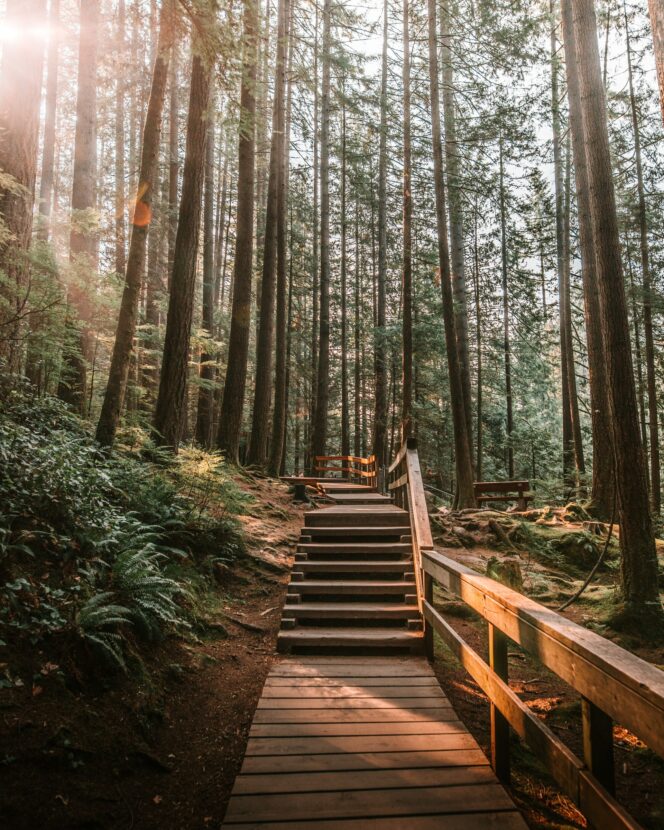
Photo: Samuel Werstak/Unsplash
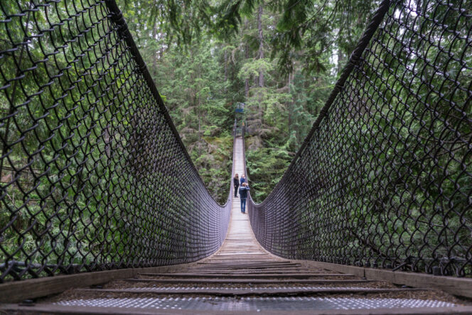
Follow the trail as you head upstream beside Lynn Creek. Detour onto Twin Falls Bridge to see the waterfalls and peer into the canyon, then continue along the Baden Powell Trail. The final section is a bit steeper with some stairs and boardwalk as you make your way towards the finish line at the Lynn Valley Suspension Bridge. Walk across the bridge, then follow the path up the stairs to the parking lot. If you’re catching the bus, the stop is a few blocks away on Peters Road.


One Response to March 2022 Vancouver Hike of the Month: Baden Powell Trail from Deep Cove to Lynn Canyon